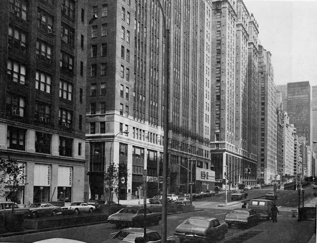
Broadway at West 32nd Street, Manhattan
 |
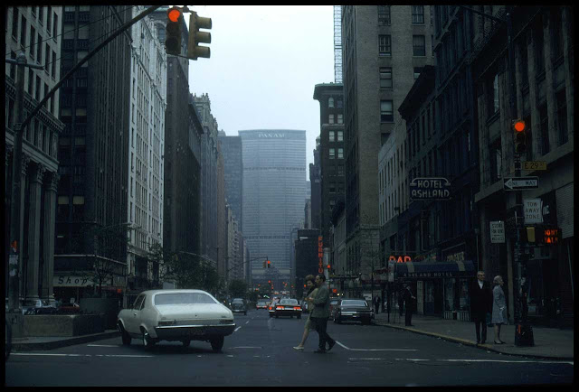
| West 32nd Street and Broadway, NYC, in 1979. |
While some neighborhood names in Manhattan mean little and were coined for purely historical or venal purposes (the "East Village," for example, came from real estate agents), others reflect the heart of change in the city. This change comes in a variety of forms, but in this case we are going to examine a demographic change. But, first, let's set the scene. Everyone who knows anything about Manhattan knows that Broadway cuts across midtown at an angle and forms several triangular parks. The most famous are Times Square and Herald Square, followed by a second tier that includes Union Square and Columbus Square (yes, you are free to quibble about judgments like that, I'm just giving you my personal take). However, there are some other such parks created by Broadway (which are all called "Squares" even though none of them is actually square) that get virtually no attention whatsoever except by local people. One of these is Greeley Square.
 |
| Greeley Square in 1971 (Hans Ketel). |
You are never going to hear a tourist from Europe or China or any other far-off place say, "I really want to go to New York to see Greeley Square Park!" And yet, these small parks are invaluable for breaking up the monotony of the grid and preserving rare bits of open space. When I saw the above photo from 1979, I decided to see what the area looks like recently. So, I did
a comparison of West 32nd Street at Broadway from 1979 to 2017. Doing this comparison revealed some subtle changes in the area of which you may be unaware.
 |
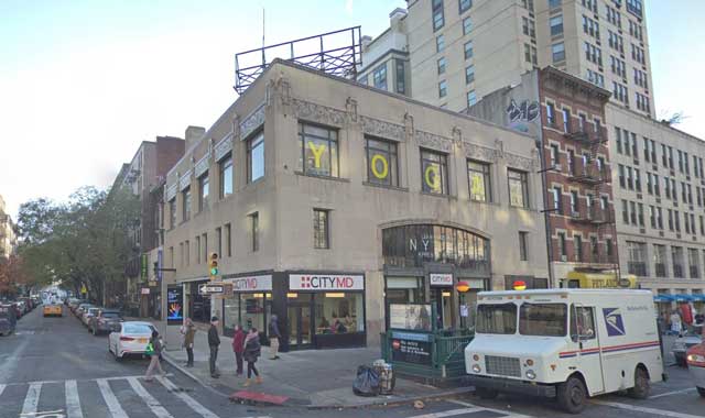
| West 32nd Street and Broadway, NYC, November 2017 (Google Street View). |
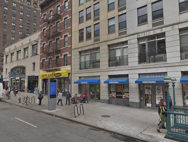
As always, the first task is to find the right spot, which isn't always that easy. I spent a few minutes pondering where the 1979 photo was taken until I noticed the statue in the park. That is Horace Greeley (1811-1872), who coined the phrase, "Go West, young man." I could not get the exact same angle in the park itself, but I think we're close enough for our purposes of seeing what kind of changes have taken place in the area (and the park itself hasn't changed that much anyway - don't worry, Horace is still there). Another reason that we know this is the exact location is 894 Sixth Avenue (the building that angles off to the right), which is a lighter tan color now but definitely the same building. Off in the distance on the left is a grand old building which appears the same - we'll get to that down below. But, enough things line up between 1979 (and 1971, for that matter) and 2017/2018 to ensure that we are in the right spot.
 |
| Greeley Square, October 2018 (Google Street View). |
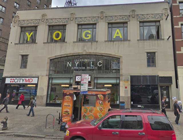
So, does our comparison tell us anything about New York City, which is one of the major themes of this exercise? Yes, it does, but what it tells us is subtle. In the 1971 photo, everything looks like everywhere else in Manhattan. There is a sign for Olden Camera, reflective of the fact that this area was part of the Photo District of Manhattan 50 years ago (previously, it had been down near the Flatiron Building). In the 1979 photo, everything still looks pretty similar, but there is some obvious Asian lettering on 894 Broadway, with the same phenomenon visible in the most recent photographs. That is our tip-off to what has changed. During the late 1970s and 1980s, Korean businesses began moving into the area, which prior to that did not have any particular connection to Asia (Chinatown is far downtown). Some sources will tell you that this did not happen until the 1980s, but here we have photographic proof that it began before then. The Asian influx became permanent and was in full swing by the 1990s (I remember a Korean friend taking me to a Korean restaurant on 32nd Street near Greeley Square in the late 1990s). Cementing the change, this area now is known as "Koreatown." So, that is our biggest change between then and now, though it may not be obvious from the photos. The buildings may stay the same, but the people using them change.
 |
| 1234 Broadway, November 2017 (Google Street View). |
To me, the most interesting thing in the scene is the ornate building in the background, so I'm going to focus on that next. It turns out to be the 1868 Grand Hotel built by carpet baron Elias S. Higgins. Now, 1868 might be just yesterday by European or Chinese standards, but in New York City, that's getting back there. New York City hadn't really extended very far north by 1868s, and this section of Broadway was still known as Bloomingdale Road (until 1899). So, we are talking about some serious history, an outpost for families (it was designed as a family residence, though it eventually became a purely guest hotel) who wanted to live in the 'burbs but close enough to "the City" to visit the shows. It would have housed the 19th Century version of the bridge-and-tunnel crowd.
 |
| The Grand Hotel ca. 1870 (Robert N. Dennis collection of stereoscopic views, New York Public Library). |
The style of 1234 Broadway is French Second Empire style, then in vogue during the reign of Napoleon II. If the Grand Hotel looks as if it belongs in Paris, that is purely intentional. The distinctive two-story mansard roof remains in place into the 21st Century, though in my humble opinion it looked more glorious when it was first built (there's a reason for that). The area changed drastically during the 20th Century, going from a classy area (somewhat like the nicer areas of the current Upper West Side) to a run-down industrial area. By the 1970s and 1980s, the Grand Hotel was run-down and a single room occupancy eyesore called the Clark Apartments. While that sounds terrible, it was a place for penurious students to get through college, so it served its purpose. Before some enterprising builder (cough cough Donald Trump) could move in and raze the decaying building, the New York Landmarks Preservation Commission (NYLPC) in 1979 designated the building as a landmark. The 1980s owners painted the roof and marble "to protect it," but that caused damage (which irritated the NYLPC, because they didn't request permission) which has never really been completely corrected. However, my understanding is that this is an ongoing situation that may eventually result in complete restoration.
 |
| Greeley Square sometime after 1912. The caption on the postcard reads, "A view of Broadway from Greeley Square to Times Square showing the upper end of the most important retail district in the world. The McAlpin Hotel, largest in the world, is shown in the foreground." The McAlpin was built in 1912, which allows us to date this somewhat. |
Now, we've looked at this area in the 19th Century and then in the 1970s. However, we've skipped about 100 years, and I can't leave this location without giving at least a nod to the tremendous change in the neighborhood that came and went in that century. The 1878 Sixth Avenue El ran up to the west of Greeley Square, dominating the square. The subway (then the IRT) went underground in 1939 when the El was razed. Omitting this chapter in the area's history would have been a travesty because the El practically defined the area for six decades. However, the El came and went, and only the buildings are left behind.
 |
| The east side of Greeley Square, November 2017 (Google Street View). |
We can see that the reddish 1912 McAlpin Hotel, now an apartment building known as Herald Towers, is still there on the east side of Greeley Square Park. Also remaining in the foreground is the 1897-1898 Hotel Martinique (apparently a play on the owner's name) apartment house, now the Martinique New York on Broadway, Curio Collection by Hilton. It is in the French Renaissance style and provides a nice counterpoint to the nearby Grand Hotel.
I hope you enjoyed this entry in our "the more things change, the more they stay the same" series. While not very well known, the Greeley Square area has a lot of fantastic history and has changed to meet new needs. Please visit some of the other entries in this series!
2019
